 Add Row
  Add
Add 


Unlocking the Earth: The New Era of Geological Mapping
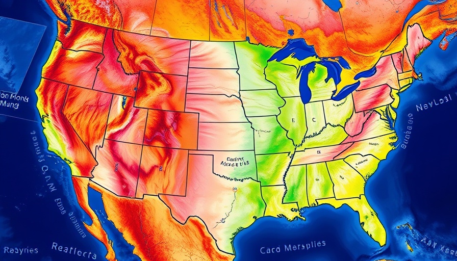
In a significant advancement for geological studies, the U.S. Geological Survey (USGS) has introduced the Cooperative National Geologic Map, the most detailed topographical blueprint of the geological makeup of the United States to date. This innovative cartographic tool is not just an academic triumph; it holds profound implications for business owners, property developers, and facility managers across the nation.
Why Geological Maps Matter
Historically, geological maps have been essential for various applications, including identifying mineral resources, managing land usage, and assessing natural hazards. The new USGS map synthesizes over 100 preexisting geological maps into a single comprehensive resource, allowing users to analyze multiple layers of geologic data effectively. This not only enhances the accessibility of detailed geological information but also provides invaluable insights into land planning and resource management.
Empowering Decision-Making in Construction
The robust functionality of this digital map is poised to serve various professionals, particularly within the construction industry. With the current surge in real estate development and urban expansion, understanding the geology beneath a site is critical for making informed decisions. The map aids in evaluating risks associated with earthquakes, soil stability, and other geological phenomena, enabling developers to strategize potential investments or interventions proactively.
Cost-Benefit Dynamics: The Value of Geological Information
A recent cost-benefit study reveals a startling fact: the economic value derived from geological maps can be up to ten times greater than their production costs. For cost-conscious businesses and property developers, this means investing in geological intelligence can lead to substantial long-term savings by mitigating risks and ensuring safer building practices. Understanding the geological context helps in not only planning developments but also in securing real estate assets.
Accessible for All: Bridging the Divide Between Experts and the Public
One of the most remarkable features of the new USGS map is its user-friendly interface that invites both geologists and the general public to explore its depths. This democratization of geological data encourages educational institutions to integrate geologic studies into their curriculums, fostering a society more informed about the land they inhabit.
The Future of Geological Mapping: Predictions and Trends
As technological advancements continue to shape our world, the evolution of geological mapping will likely advance alongside digital innovations. Future iterations of these maps could integrate real-time data inputs and AI analytics, offering an even more dynamic tool for urban planners, construction firms, and environmentalists.
In conclusion, the gesture by the USGS to provide such an accessible geological map not only bridges the knowledge divide but also establishes a crucial resource for decision-makers across various sectors. As property developments continue to thrive, understanding the foundational geology becomes a significant liability and asset management tool.
For business owners, developers, and facility managers looking to maximize their projects' viability, leveraging these insights will be key to navigating the complexities of modern-day construction.


Write A Comment